SLAM Insights and Product Information
SlamScanner.com provides insights into SLAM technology and the Feima product offerings. Check prices, get a quote, inquire about becoming a dealer or let us help you find one.
Featuring:
Choice of Professionals
SLAM200 Series Scanners
Professional Services Class SLAM Scanners
- Indoor and outdoor workflows, including industrial and infrastructure environments, with optional geospatial alignment
- Multiple range and laser channel configurations
- Deployable by hand, tripod, backpack, vest, vehicle, or drone
The SLAM200 Scanner
Top-of-the-Line Range and Capability
- Maximum range and laser configuration (300 m / 32 channels)
- Required / strongly recommended for vehicle / drone deployment
- Best suited for large outdoor sites, topographic projects, tall structures, and limited-access environments
SLAM200E-32 Scanner
Maximum Laser Density, Balanced Capability
- Maximum lasers with reduced range (120 m / 32 channels)
- Suitable for occasional vehicle or drone deployment
- Covers the same workflows as SLAM 200, with reduced
- A cost-effective alternative when full 300 m range is not required
SLAM200E-16 Scanner
Efficient, Focused Workflows
- Same range as SLAM 200E-32 with fewer lasers (120 m / 16 channels)
- Performs the same work as SLAM 200E-32, it just takes longer
- An economic choice when extended field time is acceptable
Choosing the Right 200 Model
All of the SLAM200 Series scanners share the same core platform. The right choice comes down to range, deployment mode, and time in the field.
- SLAM200: When maximum range is required or when vehicle and drone deployment are central to your workflow
- SLAM 200E-32: When targeting workflows with shorter range requirements
- SLAM 200E-16: When extended field time is an acceptable trade-off for lowering equipment cost
The SLAM 1000 & 2000 Scanners
Lower Cost Solutions
This tier is well suited to architects, contractors, facilities teams, and individual practitioners operating with lighter capture demands.
The SLAM2000 Scanner
Professional SLAM for Individual Practitioners
- Handheld, ground-based and unique tripod (rotating) workflows
- Suitable for indoor and outdoor environments
- Range of 70 m, FOV 360° H, 52° V (donut profile)
- Integrated GNSS support for outdoor alignment and georeferencing
The SLAM1000 Scanner
The Most Affordable Solution
- Handheld and ground-based SLAM capture workflows
- Optimized for indoor and non-geospatial outdoor environments
- Range of 70 m, FOV 60° H, 52° V
- Designed for lower upfront cost and practical deployment
SLAM Camp!
Hosted by SlamScanner.com
|
3-Day Training · Starts June 17 2026
A multi-day, in-person training experience focused on practical SLAM workflows, set in a distinctive industrial waterfront venue along the shores of the San Francisco Bay.
Participants receive hands-on instruction across end-to-end field data collection and SLAM data processing, building practical skills and repeatable workflows grounded in real-world use.
Deployment Modes:
Flexible by Design Multiple deployment options. One SLAM platform.
Designed to support real-world capture scenarios without locking teams into a single method.
Classic Handheld Workflow
Fast, Simple, and Unrestricted Capture
- Show up and start scanning with, just grab and go!
- Reaches tight spaces and confined areas with ease
- Keeps operators free to move, turn, and reposition quickly
- Ideal for short, fast capture sessions where speed is essential
Backpack & Vest Workflows
- Vest-mounted option provides a phone/tablet dashboard while also eliminating handheld fatigue
- Backpack-mounted GNSS antenna improves positioning performance in challenging environments, such as forestry projects.
- Backpack for safer for climbing ladders, gangways, or difficult terrain
- Optional power packs for extended capture sessions
Vehicle Mounted Workflows
- Rapid vehicle mounting using a purpose-built attachment
- Indoor/outdoor operation with optional geospatial positioning
- Moderate-speed capture on ATVs, forklifts, job carts, cars, and trucks
- Remote control via the mobile device from inside the vehicle or nearby
- Robotic-ready workflows supporting remote and autonomous capture
Drone Mounted Workflows
Aerial SLAM Capture, the Ultimate in Flexibility
- Direct integration with DJI Matrice 300 / 350 payload interfaces
- Aerial configuration w/no battery and inverted scanner
- Extends SLAM workflows into the air to complement handheld, vehicle, and tripod capture
Tripod Workflows
Cleaner Data and Unique SLAM2000 Workflow
- Cleaner, more stable point-cloud data from static tripod acquisition, eliminating motion-induced pose uncertainty during scanning
- Universal tripod compatibility across all SLAM scanners
- SLAM2000 rotating scan head enables true terrestrial-style scanning, uniquely optimized for fixed-position capture
SLAM Technology:
SLAM Positioning Engine
Simultaneous Localization and Mapping (SLAM)
SLAM enables 3D reconstruction, using LiDAR measurements, camera-based odometry, and inertial sensing to estimate motion in real time.
This sensor-fusion approach produces dense point-cloud data from a continuously moving device across complex environments.
Hesai "Puck" LiDAR Sensor
- Range Accuracy: ~±2 cm (LiDAR sensor spec)
- Precision (noise): ~1–3 cm (1σ) (1σ, sensor-level repeatability)
- Horizontal angular resolution: ~0.1°–0.2°
- Point rate (sensor output): 320k–640k pts/s (before any SLAM downsampling/filters)
- Signal quality: Low-noise, high-sensitivity returns
System Output Comparisons
- SLAM200 (32): ~192 million points in 5 minutes (~640 k pts/sec)
- SLAM200 (16): ~96 million points in 5 minutes (~320 k pts/sec)
- SLAM2000: ~60 million points in 5 minutes (~200 k pts/sec), articulating head increases angular diversity
- SLAM1000: ~60 million points in 5 minutes (~200 k pts/sec)
Multiple-Return LiDAR
Multi-return sensors allow a single laser pulse to register multiple reflections. This capability has been common in aerial LiDAR for canopy and ground separation, but not typical in terrestrial scanning platforms.
These SLAM scanners support multiple-return sensing, getting more data in layered or partially occluded environments.
Feima Designed a Custom IMU
As a SLAM device moves through a scene, the IMU continuously measures orientation and motion, allowing LiDAR observations to remain spatially coherent over time. An effective IMU is critical to accurate SLAM.
- Feima scanners use a custom-designed inertial navigation module
- Developed after off-the-shelf IMUs proved insufficient for mobile SLAM
- Deep IMU integration reduces cumulative trajectory drift
Environmental Durability
Built for real-world field conditions
- IP54 Ingress Protection
- 5 = Dust-protected (limited ingress, no operational impact)
- 4 = Protected against splashing water from any direction
- Designed to withstand vibration, handling, and field “stress”
SLAM GO: Field Software
Real-time capture control & live SLAM feedback
- Live trajectory and point cloud preview during capture
- Device control, scan session management, and status monitoring
- RTK correction service connectivity for on-site geospatial alignment
SLAM GO POST: Office Software
Desktop Data & Geospatial Management
- SLAM data ingest, filter, down sample, and point cloud construct
- RTK and PPK workflow support for absolute geospatial alignment
- Panorama generation and visualization tools for review and QA
- Industry-standard export formats: E57 and LAS
Feima Robotics, a Geospatial Capture Leader
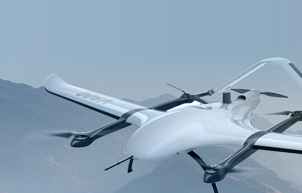
Feima’s background spans large-scale UAV systems, multiple LiDAR and camera payload types, and deeply integrated positioning workflows, including GNSS and RTK. They deliver some of the largest UAV platforms globally, including more than 50 dedicated payloads from specialized cameras to airborne LiDAR systems.
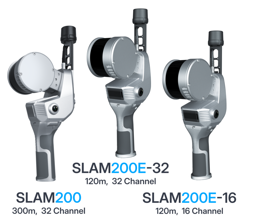
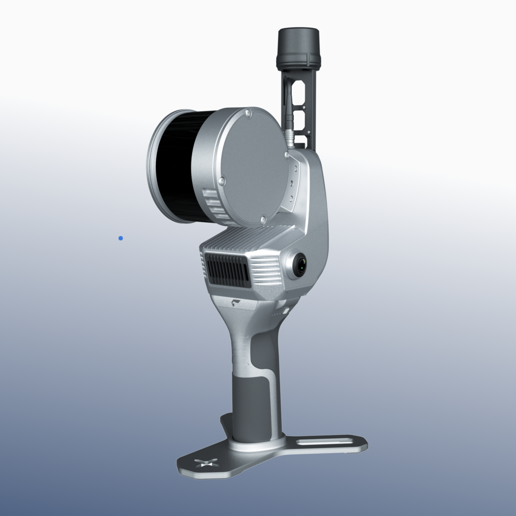
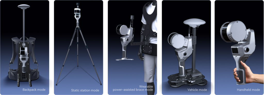
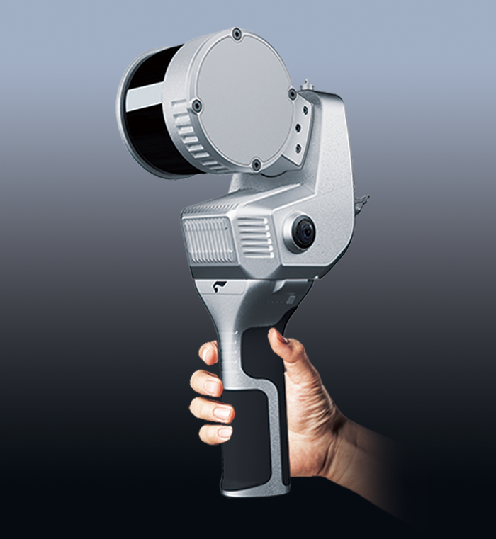
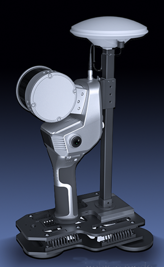
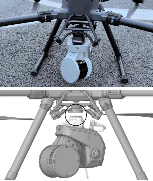
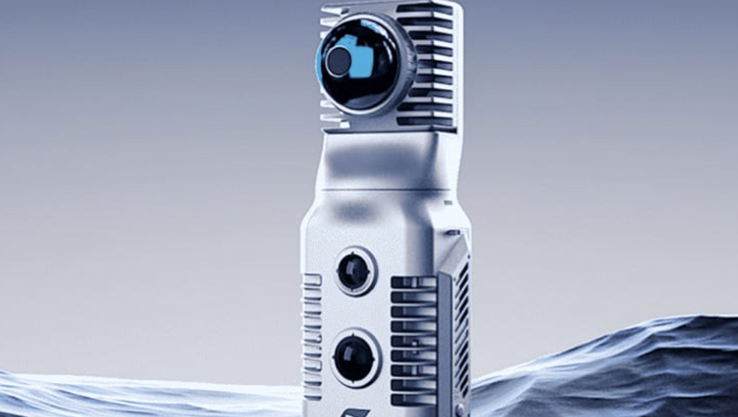
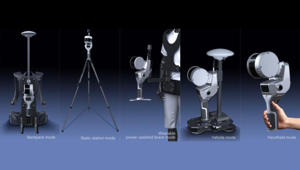
That experience shows up in their handheld SLAM systems designs. The hardware feels purpose-built rather than rushed, and the platform is flexible enough to support handheld, wearable, drone and vehicle-mounted options, all with available GNSS-integrated configurations. It reflects a team that understands how these tools are used in the field.
Notices
Twice Monthly SlamCast
We have a SlamCast every 1st and 3rd Thursday of the month at 1:00 Pacific time. Join us as we spend 30 minutes delving into valuable SLAM subjects.
- Best-practice field workflows
- Working with geospatial coordinates
- Technical insights
- Getting data into your favorite as-built software
- And more
How I Got SLAMmed!!!
I just posted an article about how I ended up leading the charge here at SlamScanner.com. I hold this hand held SLAM marketplace and technology in the highest regard.
I didn’t set out to be in this business exactly, but my long background in infrastructure technologies and reality capture solutions led me to this place.
Read the article here
Bill Wallace
Let’s get you set up to SLAM
We’re ready to help you with product selection, workflows, and dealer opportunities.